Translate

jueves, 7 de mayo de 2015

FROM AMADORIO'S RESERVOIR TO EL CANTAL

Today we will continue talking about circular routes. This one calls for a medium physical condition or you will finish exhausted. It takes 5 hours and its lenght is around 17 km. So I recommend to take a rest 1 or 2 times at least.

This time we will start in Maisa Lloter's sport center because there is a big car park and we can use it.

The first thing we will see today is the Sella's dam. It is amazing. It was the second time I was in a dam. But I liked it more than the Guadalest's dam which was my first time. I don't know why. But I am sure that you will agree with me.

miércoles, 6 de mayo de 2015

ASICS GEL-FUJI TRABUCO

Good evening friends! 

Thinking about my experience going hiking I believe necessary to talk to you about my unconditional mates. 

I bought it three years ago, when I was preparing all my luggage to go to Camino de Santiago, and now I can't conceive a walk without it. I'm talking about my Asics Gel-Fuji Trabuco.

My Gel-Fuji Trabuco shoes
 
These shoes incorporates a perfect sole for running and hiking for the most difficult surfaces. In addition, the deep grooves of their sole provide grip during ascents and descents. Is important to say that if you use to going runnig or hiking on asphalt surfaces you'll wear away the deep groves and lose this characteristic of the shoes too early. 
 

Another thing to underline of these shoes are its air chambers localizated on the back of the shoes. It allows you to attenuate the coup during the phases of impact and drive the foot and favors movement in multiple planes as the foot makes the transition during the stride cycle.


And the last thing I love of these shoes is its lace pocket. I never had a shoes with this complement and I like to introduce my laces into this little pocket and forget it until I finish my route. I think it's a fantastic idea!! 


Visit the website of Asics to see the trail shoes on this link

Hope you enjoy the information!


IBP INDEX

What is IBP index?


The IBP index is an automatic valuation system that scores the hardness of a mountain bike, road bike, hiking or running trail.
This index is very useful to know the difficulty of different trails by comparing them.
It is very important not to confuse the difficulty of a trail with the effort that will take us to realize it: an IBP index of 60 will be a very hard trail for a debutant, normal for someone with a medium preparation and very easy for a professional.

  Suffering or efforts of a trail = fitness + race pace + climatologic conditions + IBP
The index is obtained by analyzing the latitude, longitude and height data registered by a GPS device. The distances done in the different sections of ups and downs (1%, 2%,3%,4%,etc..), the total ascended and descended meters, average ratios of climb and descend, the mileage of height and the ramps’ distribution are taken into account.

Applying a standardized mathematic formula you obtain a punctuation between 0 and infinite. This punctuation is 100% objective because it doesn’t take into account subjective values such as climatology, the fitness or the race pace.

The system detects automatically how the trail has been made. Therefore, the difficulty index that is going to be obtained will be followed by the following abbreviations: BYC for cycling trails, HKG for hiking trails and RNG for running trails.

It is also possible to obtain de IBP index of a trail drawn in a map manually, as long as the trail points contain the height. In this case the index will be followed by the abbreviations DRW. However, the index obtained this way won’t have the same reliability, due to the precision mistakes when marking the points or altitude mesh’s mistakes.

Information retreived from 
http://www.ibpindex.com/index.php/en/

martes, 5 de mayo de 2015

YETI SB5

Good morning riders!!

 
Today I want to show you a bike, but not a normal one, this one is a special one. 


What has Yeti SB5 to makes it special? The most characteristic thing is its double suspension, which is the newest on the market. The sistem of this suspension is Switch Infinity.
From Guijarro Altas del pi
With it 127mm lenght on the suspension it's the most versatile bike for all types of land. 

 
Talking about its frame, I have to underline that it is made with carbon, so it's to light. 

From Guiijarro Altas del pi

One of the things that stand out these bycicles is you can customized it to your liking on the website. For this reason is for what I'm going to give the link to enter on the website and enjoy your making process. 

Hope these handlebars can drive you to some of our routes!!
From Guijarro Altas del pi

lunes, 4 de mayo de 2015

MAVIC TEMPO

Mavic's catalog of cycling shoes is one of the largest and most recognizable in the market. One reason for this is that all their shoes maintain a well-marked sign of identity. 

There are a lot of different shoes desings and prices. Our recommendation today is about the Mavic Tempo. A very good shoes for MTB. It costs around 150€. But it worths.

Mavic Tempo

viernes, 1 de mayo de 2015

PLA DE PETRACOS (CASTELL DE CASTELLS)

Today we start in Castell de Castells (Marina Alta) direction to Benigembla.

Castell de Castells (from Wikipedia)

The way goes down until it gets next to the river. Few minutes later we will arrive to "Fountain l'Espelda" where we can relax and take some pictures before continue our trail.

After that we will arrive to the Malafi's Ravine. A place listed as patrimonio of humanity.

AITANA ACTION VIDEO

Hi again mates...!

As we did at the begining of this week, today we're bringing you a new action video.

This one is filmed in Aitana during our last route over there. You can remember it in this link, and don't forget that we also posted another Aitana's route on the hiking section that you can see here.  

The video shows the path that goes from "Font de L'anouer" to Aitana's lunar landscape, right on top of Partagat recreational area.

I can only say that it's an amazing feeling enjoying this privileged environment with friends and your lovely bicycle ;-)

Don't hesitate to discover Aitana either by MTB or hiking, both are splendid choices. 

From marinabaixamtb&hiking we encorage you to spend a day in Aitana.

Enjoy the video and remember you're part of this blog with your comments.


jueves, 30 de abril de 2015

OUR FOLLOWERS' FEELINGS ABOUT THE BLOG

Good evening followers, here is another podcast. This time is an interview to Abbie, and we asked some questions related to our blog in order to know how did she connected with it, if it is useful or not and why, her way of life related to sport, etc.

From flickr.com

I hope you can enjoy her information and if you have other questions to us or to her, just post a comment and we will be glad to answer you! 

Just press play on the player and listen to the podcast!!


STARTING A TRAIL CLUB

Group of people in the environment (from Len Hardy in www.firehole.us)

Nowadays people are more interested in environment and sports practised in it.

Consequently, local and regional governments  have changed their politics and they try to conserve it. However, it is not always this way.

An option we have to defend our local trails is to create a trail club.

miércoles, 29 de abril de 2015

DIFFERENCE BETWEEN HIKING AND TREKKING

Yesterday I talked about our blog to my friend Andrew. He told me that he liked it very much. But he asked me a very good question: "I don't understand" -he said-. Why do you say always HIKING and not TREKKING?"

Initially, I did not know what to say to make him understand what is the difference. I had never thought about it before. But I discovered there are many people that have the same doubt.

So, what is the difference between hiking and trekking? Are them the same thing with different names? Do you know the correct answer?

martes, 28 de abril de 2015

CIRCULAR ROUTE IN CONFRIDES

This time I will explain you another circular route. But pay atention. Its 19km takes around 6h. Then I would not start this route if you are not prepared.

The path is not difficult itself. And there are not a lot of cross. So it isn't easy to get lost. However, 19km are too much and the cumulative altituded is around 800m. Because of these reasons I would classify this route to high level.

lunes, 27 de abril de 2015

"EL CANTAL" ACTION VIDEO


Hello Bikers...!

Recently a friend of mine has bought an action cam. Today I've received some of the videos that he's been recording during our routes.

domingo, 26 de abril de 2015

HELL'S RAVINE

This route does not in Marina Baixa exactly either. But it is very close.

I want to talk about it because it is one of my favourites routes althought I couldn't finish it because of time. I had to leave from Fleix (place where "Hell's Ravine" is) and I came back before expected.

And I will say you more, we (Mario, Ana and me) want to do it when we finish our last exams. I dare you to come with us!

sábado, 25 de abril de 2015

WELCOME TO SPAIN!

Hi again guys!

This is a special issue to me. I will start by talking about Spain and I will finish by encouraging you to chose Marina Baixa as your next destination to visit on holiday.

Spain (from: Wikimedia Commons)

Maybe you think i am crazy. But I am sorry to say that you are wrong! Okey, I will explain it to you. This morning surfing on Internet I found a PDF from "Made for Spain" in collaboration with "Travesías".

The document tries to "share the best finds and even some secrets" of Spain to everybody. Who did this PDF is completely sure that you will change your mind about Spain after reading it and you will want to come here as soon as possible. And... why should not I tell it to you? I totally agree with them.

Would you like to know more about things it talks about?

KNOWING OUR FOLLOWERS

Good morning friends!

This morning I interviewed Julia, a reader of our blog who wants to share with all of you her feelings about this blog. 

We prepared some questions in order to know important things like how she connected to our blog, or if she practise MTB or hiking and her reason to do one, other or both. 

If you want to know more things about other readers and share with us your impression or questions to make in future interviews, just listen to the podcast and comment!!


We are waiting for your comments!!


From google images

viernes, 24 de abril de 2015

A PRATICAL GUIDE TO GOOD PRACTISE

Hi guys!

I am still trying to give you information related with mountain sports. This time i have found a PDF document from United Nations Environment Programme (UNEP) about tourism and mountain. So it is exactly what I was looking for.

It can not be read in 5 minutes because it has almost 50 pages. However, quite of these pages maybe do not interest you because there are much information that you already knew. But please, have a look to the follow PDF. 

jueves, 23 de abril de 2015

FEDME LICENSE

Hello!

This time we are going to talk about Spanish federation of mountain sports and climbing (FEDME) license.

Again I have done a presentation to explain the most important information you should know about being federated.

miércoles, 22 de abril de 2015

CIRCULAR ROUTE IN TÁRBENA (TÁRBENA; BENIPLÀ; BARRANCO DE LES VIUDES; FUENTE DEL OLBIS; FUENTE DE BENISSALIM; TÁRBENA)

Good afternoon followers! 

Today I'm going to show a circular route to do hiking or riding, depends of your interests! This route starts and finishes in Tárbena, so the first thing you have to do is go to Tárbena. 

Drive on the CV-715 to Tárbena. Turning to the Avinguda d'Eusebio Signes find first the route information panel. Pass this panel and continue on the Avinguda d'Eusebio Signes to parking your car on your right.

How to arrive to Tárbena
Once you are in Tárbena you'll start the route. It will take you four hours (if you go hiking) more or less because it has 15 km, but if you go with your bike it will take you one hour and a half aproximately.

The path crosses a track and descends to a fountain and a well. Next to the fountain the path turns right and then flows into a track. Walk about 10 meters left this cement track and turn right side up. Soon you will reach another track of cement. Turn left down. When the track forks, take the dirt track on the right. At the next crossroads go left down.

A part of the circular route. By: topwalks.
On your left rises Aixorta and Aitana mountains. Track up to La Muntanya, and then down the Barranco de les Viudes, where you will find another track. Turn right side up.


Below you'll find the source of the Olbis. The track turns into a path near the ruins of a building and begins to descend zigzag to a field of almonds.

After passing the hotel Lehmi, track becomes a path, which ascends through a flowery landscape to the source of Benissalim. This wonderful source is surrounded by Apple, pear and plum trees. From the source take cement track left up. Arriving at the CV-715, turn left and return to Tárbena.

Barrando de les Viudes. By: topwalks

I think this is a fantastic route to do with your family and friends, you'll carry something to do a brake in the middle of the route, and don't forget to take some photos, it has fantastics views!!


HOMOLOGATED PATHS

Hi everybody!

Today I will try to explain you briefly what does a "homologated path" means. It is basically a trail which has been approved by a regional or territorial federation. So we could say that it has been accepted and, in theory, safer because it is controllated periodically.

Hiking signaling (from Wikimedia Commons)

martes, 21 de abril de 2015

HOW TO CHANGE A RIM

Good morning readers!!

Today I'm going to show you a ppt I made with the necessary steps to change a rim if you get a flat tire, which is a common thing when you're riding your bike at the mountain!

From: http://da.wikipedia.org/wiki/Mountainbike

So, cheer up to learn how to do it with these easy 15 steps!

domingo, 19 de abril de 2015

WHAT TO DO WITH AN HEMORRHAGE


Good evening everyone!! 

I'm sure that once, al least, you suffer a scratch with a plant or a stone while hiking or riding at the mountain. For this reason is for what I think it is necessary to know what to do if there is a plentyful hemorrhage in some part of the body. 
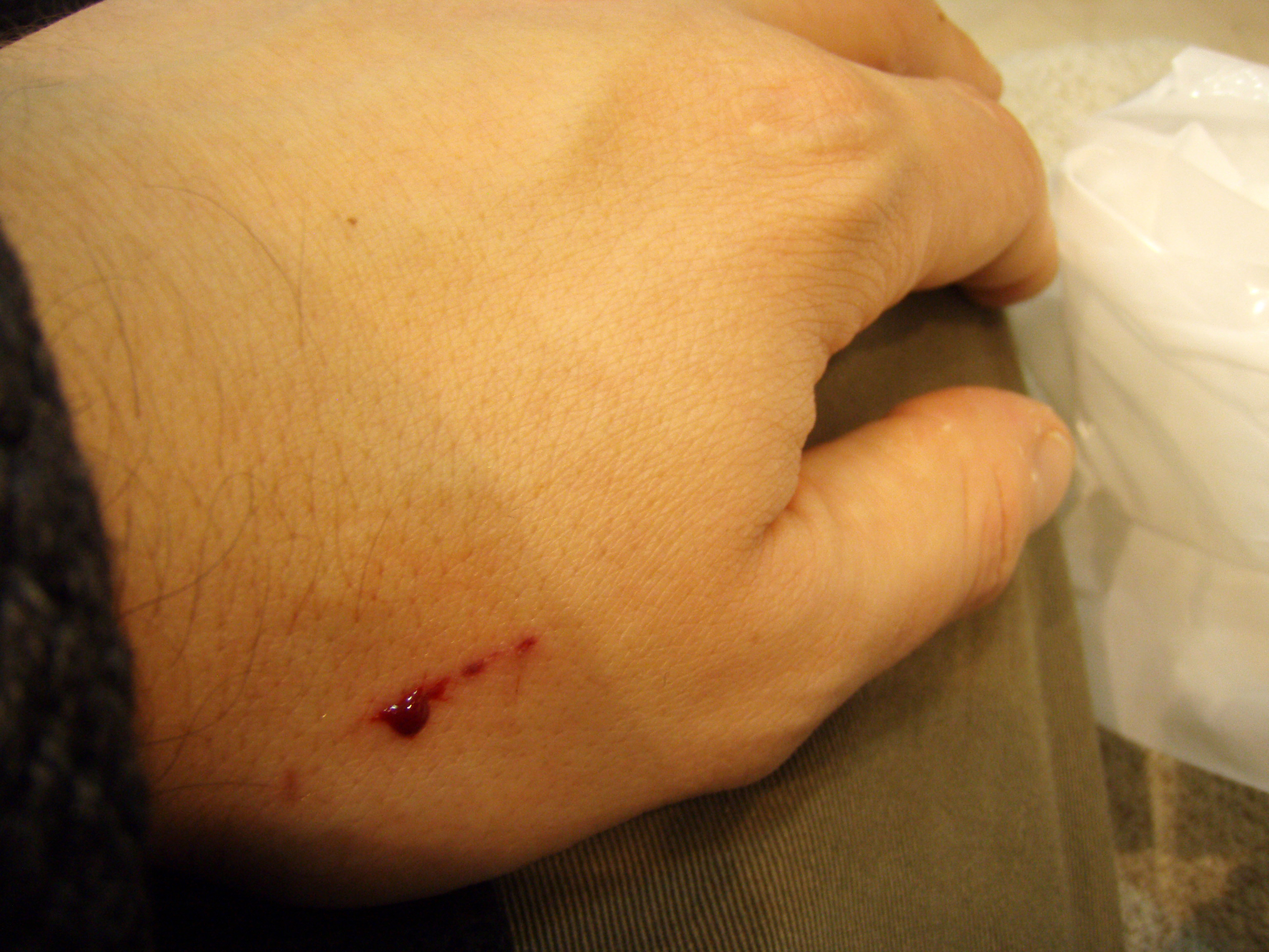
A small scratch

So, now we are going to see how you have to act if there is an abundant hemorrhage, not like the one of the picture. 

The steps to follow are these:

  1. Lay casualty down.
  2. Raise the injured part of the body in order to avoid blood arrive to the scratch.
  3. Try to block the exit of the blood with something like a towel, a piece of sheet or T-shirt.

What to do with an abundant hemorrhage


The block of the arteries is different depending the localization of the scratch. So here is a picture that explains where you have to put pressure depending the blooding zone:


Where to block the arteries


 Talking about hemorrhages it is important to say that the famous tourniquet will only be used in four situations, because we can cause a lack of blood at the zone which can cause the necessity of an amputation. The four situations in which we will apply a tourniquet are:

  1.  In huge catastrophes because the numbers of casualties will be higher than the number of people who can help the injured people and stay for a long time putting preassure on the scratch.
  2. When exist the possibility of bleed to death. This is because is better to lose a leg or an arm, than to dead as a consequence of losing all the blood.
  3. In situation of smashing. First of all in order to avoid the bleed to death when raise the object which is squashing, and to avoid the exchange of bad substances with the risk of infection of the injured person.
  4. In case of a traumatic amputation because there isn't anything to feed next to the cut.     


To know how to make a tourniquet just you have to see this image and know that you must write the time when you apply it and don't cover it in order to guarantee medical people can see it.


How to apply a tourniquet